
Wreck fishing consistently produces trophy catches because submerged ships, barges, and artificial reefs create vertical structure that attracts sea bass, cod, grouper, amberjack, tuna, and sharks. These underwater formations disrupt currents, concentrate baitfish, and provide shelter, making them fishing gold mines in waters deeper than 100 feet. Even shallow wrecks between 20 and 60 feet draw striped bass, blues, and reef predators. Finding productive wrecks is not about luck. It requires combining official databases, advanced sonar, and systematic search techniques to locate real, fish-holding structure.
This guide reveals how to use free tools like the Florida FWC database and NOAA Bathymetric Viewer, deploy GPS and fishfinders effectively, and apply battle-tested scouting methods used by expert anglers. You will learn how to verify wreck positions, avoid common mistakes, and adapt tactics based on conditions.
Access State Artificial Reef Databases
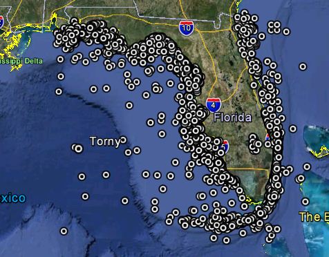
Official artificial reef programs provide accurate, legal, and well-documented wreck locations that serve as your foundation for finding productive fishing spots.
Florida FWC Reef Data
The Florida Fish and Wildlife Conservation Commission maintains the most comprehensive public wreck database in the United States, with over 3,800 verified entries including GPS coordinates, depths, materials, and deployment dates.
To access this resource, search for Florida reefs and wrecks and select the official myfwc.com result. Click Explore and Download Locations and choose Excel format for easy filtering. You can filter by county, with Broward and Palm Beach containing 233 combined entries, or by depth targeting 100 to 200 feet. Copy filtered data into a custom spreadsheet and import latitude and longitude pairs directly into your chartplotter.
Report changes to artificial reef conditions at ArtificialReefDeployments@MyFWC.com. Some sites may have shifted or degraded over time, so always verify before relying on older data.
South Carolina SCDNR Reefs
South Carolina’s Department of Natural Resources publishes detailed lists of offshore wrecks and artificial reefs, many buoy-marked or GPS-verified. Key sites include Vermilion Reef featuring a 460-foot ship at 110 feet, Betsy Ross Reef with a 430-foot Liberty Ship at 90 feet, Comanche Reef holding a 165-foot Coast Guard cutter at 105 feet, and Edisto Sixty Reef containing the 330-foot ship Page at 65 feet.
Materials range from landing crafts and barges to reef balls, subway cars, and military APCs. Many remain unmarked, requiring GPS navigation for precise access.
New Jersey Reef Booklet
New Jersey’s Artificial Reef Program has deployed over 500 structures since 1984. Their full-color reef booklet features accurate GPS waypoints, depth charts, structure descriptions, and maps from Sandy Hook to Cape May.
This resource is designed for small boats and works exceptionally well for weekend trips targeting sea bass, cod, and blackfish. Structures include subway cars, concrete modules, and decommissioned vessels.
Scan NOAA Bathymetry Maps for Hidden Wrecks
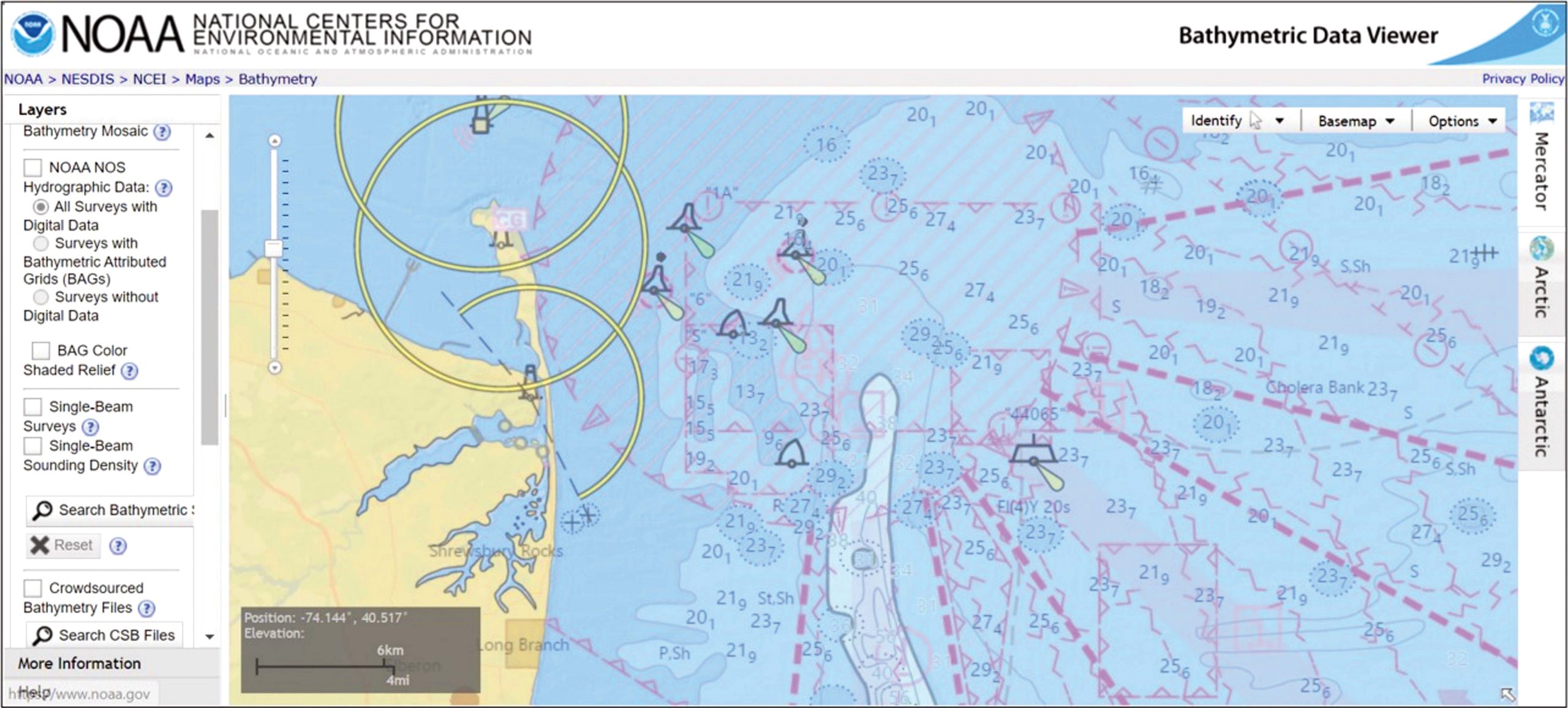
Discover undocumented wrecks using free, high-resolution seafloor imaging from NOAA that reveals man-made structures invisible to casual observation.
Access the Bathymetric Viewer
Navigate to the NOAA Multi-Beam Bathymetric Data Viewer by searching NOAA multi-beam and selecting the official site. Click Bathymetric Data Viewer to load the interactive global map. This tool shows sonar-mapped seafloor topography worldwide and receives regular updates, so revisit every six to eight months for new coverage.
Detect Wreck Signatures
In the viewer, uncheck all layers except Bathymetric Color Shaded Relief. Look for anomalies indicating man-made structures including sudden vertical rises above flat seabed, angular shapes suggesting hulls or machinery, linear patterns inconsistent with natural terrain, and debris fields radiating from a central point.
The William H. Mackin, a 100-meter-long wreck in Long Island Sound, was identified solely through its distinct sonar signature before being confirmed by divers.
Pinpoint Coordinates Accurately
The viewer displays coordinates to three decimal places providing approximately 360 to 500 feet accuracy. To refine your position, zoom in tightly on the target and note the base coordinate. Pan incrementally and observe when the third decimal changes. Estimate a fourth decimal by calculating halfway as .5 and three-quarters as .75.
This achieves sub-100-foot precision, enough to navigate directly to the site without additional searching.
Run a Grid Search Pattern to Confirm Locations
When coordinates are approximate, use Norman’s grid method to find the exact wreck location through systematic coverage.
Execute the Search Pattern
Enter the reported GPS point into your chartplotter and mark it with a wreck icon. Navigate to the spot and switch to plotter mode. Clear previous tracks and zoom in as close as possible. Align your boat due north using the compass.
Move slowly northward in a straight line while watching the fishfinder. Use 2X zoom to detect subtle bottom changes. If you see a hard return or vertical relief, mark the spot immediately with the GPS Mark function. After passing 50 meters beyond the original icon, make a tight port turn and run due south, parallel to your first pass. Space each run about 50 meters apart.
Complete a 50-meter-wide westward grid, then return to the icon and repeat eastward. Once multiple marks cluster around the original point, the true wreck position is confirmed.
This method works even if initial coordinates are off by hundreds of feet. Use it during calm, non-fishing days to pre-scout and verify sites. Save the final mark in GPS memory for future trips.
Watch Your Fishfinder During Transit
Many top wreck spots are found accidentally while crossing open water, turning routine runs into discovery opportunities.
Look for Unexpected Bumps
Leave your echo sounder running even when not actively fishing. On otherwise flat bottom, watch for hard returns indicating metal or concrete versus sand or mud, vertical relief showing structure rising from the seabed, and fish arches near the bottom. A sudden bump could be a wreck, rock pile, or debris field waiting to be discovered.
The famous Meatloaf wreck in Southern New England got its name because the captain was eating a meatloaf sandwich when he spotted it on the sounder.
Return for Investigation
Do not stop mid-transit. Continue to your destination, then return later to investigate the anomaly. Use the grid search method to confirm the structure and assess fish activity. This passive scouting builds your personal database over time.
Learn From Commercial Fishermen
Commercial crews often know the best bottom structure from years of net dragging across productive fishing grounds.
Access Hang Books
Fishermen record hang-up locations where gear snags on obstructions, often marking wrecks, rocks, or debris fields. Retired captains may share their hang books revealing prime fishing spots. Capt. Joe Rendeiro of Stonington, Connecticut shared his offshore log exposing multiple cod hotspots now used by recreational anglers.
Convert Legacy Coordinates
Old hang books may use LORAN-C coordinates requiring conversion to GPS. Accuracy can degrade due to unknown cable length between boat and gear, typically 300 to 500 feet. To locate the actual snag, center the reported point and run a grid search over a 300-foot box or even a mile-wide zone. Use your sounder to detect structure and confirm the target.
Wreck hunting requires patience, time, hard work, gas dollars, and more patience.
Drift Over Verified Wrecks Effectively
Once you have confirmed a wreck, drifting lets you cover structure without anchoring while adapting to fish location.
Manage Your Drift Path
Approach upwind or uptide so your boat drifts naturally over the wreck. Watch the fishfinder to identify the highest part of the structure, fish-holding zones, and debris fields. Mark productive spots with GPS. When the bite slows or you drift too far, reposition and repeat.
On calm days, you can hold over the wreck for extended periods, making catching fish like shooting ducks in a barrel.
Control Fast Drifts With a Drift Sock
In strong current, standard sinkers may not hold bottom. Use a drift sock attached amidships on the upwind side. It acts like a parachute to slow drift. Match size to boat length and weight. Assign a crew member to manage deployment and retrieval to avoid entanglement with props or cleats.
Use Spot-Lock or Power Drifting Technology
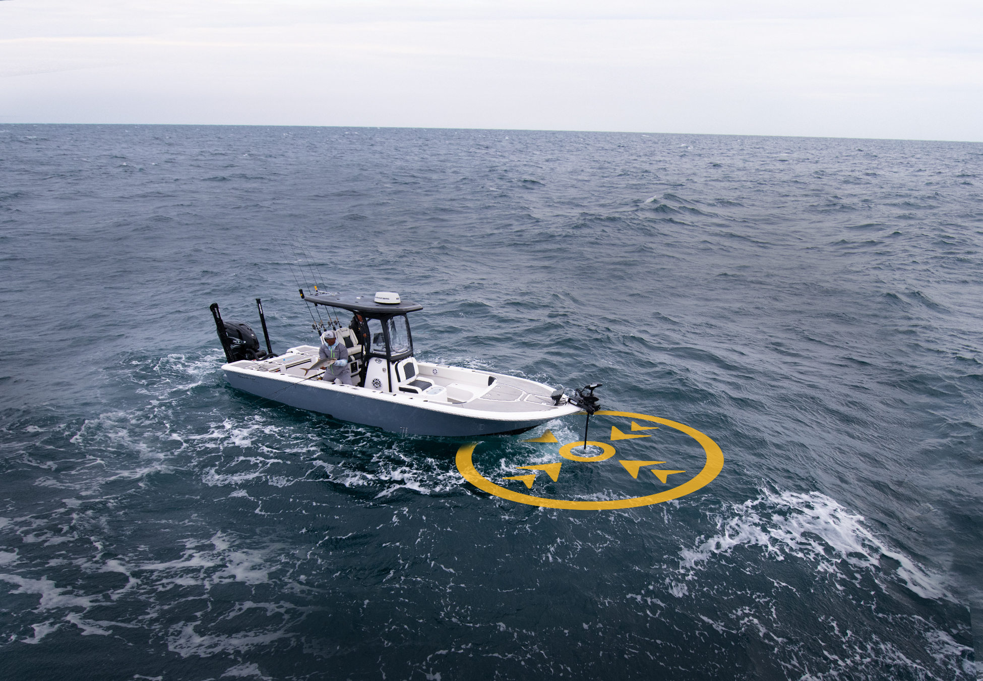
Maintain precise position over wrecks using modern technology that replaces traditional anchoring.
Activate Minn Kota Spot-Lock
The Minn Kota Terrova Riptide with Spot-Lock holds your boat over a GPS waypoint like an invisible anchor. The jog function moves the boat in 5-foot increments for precise adjustments. Drift Control fine-tunes speed with reverse thrust.
This system costs far less than joystick piloting but delivers similar precision, ideal for budget-conscious anglers.
Stem the Tide Under Power
For maximum control, drift while powering into the current. Stern-first keeps the transom flat against waves but risks swamping in rough seas. Bow-first is safer and easier to steer but may drift sideways if current hits the beam.
Twin-engine boats have an advantage. Systems like Mercury Skyhook, Yamaha Helm Master, or SeaStar Optimus 360 use GPS and independent engine control to hold position automatically.
Anchor Strategically on Complex Structure
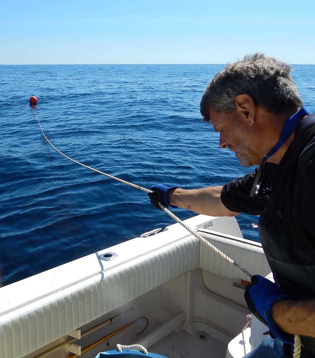
Anchoring gives full control over your position on deep or complex wrecks where drifting proves ineffective.
Use a Dual Anchor System
The combined primary plus grappling hook method prevents swinging and allows fine-tuning. Use a 14-pound plow or Danforth anchor with 10 to 12 feet of chain and 500 to 600 feet of 3/8-inch nylon rode. Add a 10-pound grappling hook with three or four prongs made from coated rebar on 300 feet of line with 6 feet of chain.
Drop both anchors separately. Adjust tension to snug up closer to the wreck, drop back to fish edges, or stay clear of snags. Store the grappling system in an orange commercial fish basket to prevent tangles.
Upgrade for Deep Water
For trips in 150 feet or deeper, add a 200-foot braided nylon extension to your main rode. Carry a secondary 14-pound Danforth with 600 feet of 7/16-inch line in a 100-pound fish box. Use an anchor ball on the line to make retrieval easier.
Troll Around Wreck Zones for Pelagic Action
Cover large areas and trigger bites from pelagic predators using trolling patterns around productive wrecks.
Pattern Around Productive Structure
Capt. Mike Modica of Uncle Mike’s Charters uses a reciprocating north-south-east-west pattern within a half-mile radius of the 30-fathom Coimbra wreck. Even in low visibility around 200 yards, this method produced five bluefin tuna in one hour while nearby boats caught nothing.
Trolling avoids crowded fleets and finds actively feeding fish moving around structure.
Target Pelagic Species
This technique excels for bluefin and yellowfin tuna, mako and thresher sharks, and bonito. Use diving plugs, feathers, or rigged ballyhoo at speeds of 5 to 8 knots. Vary depth with planers or downriggers to match the thermocline.
Jig or Drift Bait Near Active Fish
Switch tactics based on fish behavior and the species you are targeting for maximum success.
Vertical Jig for Aggressive Feeders
When bait schools flee predators marked by birds or inverted V echoes on the sounder, stop the engine and drop metal jigs to the bottom. Begin vertical snap-jigging. This method works exceptionally well for tuna, amberjack, grouper, and cobia.
Use snap-jigging spinning rods that outperform traditional bait rigs when fish are active.
Drift Bait for Trophy Sharks and Tuna
For large sharks, drift near 20 to 35 fathom wrecks from May through November using fresh cut bait. A 388-pound male thresher shark was landed on light tackle using this method.
For tuna, drift chunk baits in the shadows of 20 to 30 fathom wrecks. Let current carry bait naturally. This method has produced enough tuna to buy a new 30-foot boat.
Frequently Asked Questions About Finding Wrecks for Fishing
What is the best free database for finding artificial reef locations?
The Florida FWC database offers over 3,800 verified entries with GPS coordinates, depths, and structure descriptions. South Carolina SCDNR and New Jersey also provide comprehensive reef booklets. NOAA Bathymetric Viewer works nationwide for discovering undocumented wrecks.
How accurate are shared GPS coordinates for wrecks?
Many shared GPS coordinates are outdated or inaccurate. Some wrecks have shifted, degraded, or been salvaged without updates. Always verify coordinates using the grid search method before relying on them for fishing trips.
How do I use NOAA bathymetry to find wrecks?
Access the NOAA Bathymetric Data Viewer and select Bathymetric Color Shaded Relief. Look for anomalies like sudden vertical rises, angular shapes, linear patterns, or debris fields. Zoom in closely and estimate the fourth decimal for sub-100-foot accuracy.
What is Norman’s grid search method?
Enter suspected coordinates and mark the location. Run north-south passes spaced 50 meters apart while watching the sounder. Mark any structure detected. Complete the grid in both directions. Multiple marks clustered around the original point confirm the true wreck location.
Can I find wrecks accidentally while fishing?
Yes. Keep your fishfinder active during transit. Look for unexpected bumps or hard returns on otherwise flat bottom. Mark the spot and return later to investigate using the grid search method.
What gear do I need for wreck fishing?
Use a quality fishfinder with 2X zoom capability and a chartplotter for GPS navigation. For fishing, carry conventional reels with braided line and wind-on leaders, two or three-hook groundfish rigs, and snap-jigging spinning rods for active fish.
Key Takeaways for Finding Productive Fishing Wrecks
Finding productive fishing wrecks combines research, technology, and on-water skill. Start with free state databases including the Florida FWC, South Carolina SCDNR, and New Jersey reef programs. Verify locations using NOAA bathymetry and confirm with systematic grid searches. Keep your fishfinder running during transit to build a personal database over time. Learn from commercial hang books and convert legacy LORAN coordinates when necessary.
Master multiple positioning techniques including drifting, using drift socks, activating Minn Kota Spot-Lock, or anchoring with a dual anchor system. Carry specialized tackle like snap-jigging rods that outperform traditional bait rigs. Adapt tactics to conditions by switching between drifting, anchoring, and trolling based on wind, current, and fish behavior.
With patience and persistence, you will turn forgotten shipwrecks into your most reliable fishing destinations. Start building your personal library of verified wreck spots today.